94% of Chinese live east of the Hu Line!
• In the North China Plain, the red area in the northeast
• The Sichuan Basin, that red circle in the middle
• Small dots along the coast
• The regions between these 3
Why?
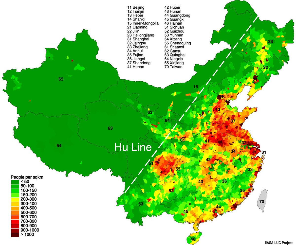


The mountains.
— Tomas Pueyo (@tomaspueyo) February 7, 2023
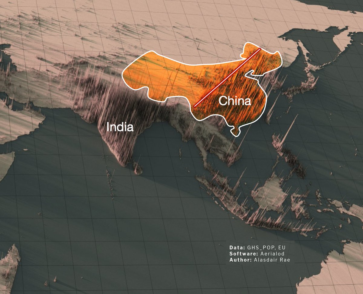
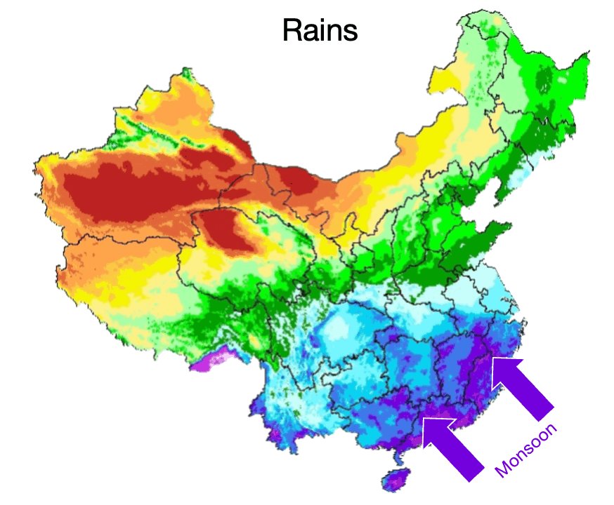
Wind comes from the ocean full of water
It hits the Himalayas
Climbs up
Gets colder
The water condensates and rains down pic.twitter.com/f06c0MHSjc


and, finally, here's a population density render of the entire world - zoom in, or open the image in another tab/window to see the fine detail here - it comes out quite well even at this scale
— Alasdair Rae (@undertheraedar) May 5, 2020
(this escalated slowly, but I got there in the end\U0001f30d) pic.twitter.com/VlJOF7mVpR
France is weird:
— Tomas Pueyo (@tomaspueyo) June 2, 2022
Why is it the biggest sea country worldwide?
Why was it the most powerful?
Why not anymore, even in Europe?
Why the only EU country that belongs to both north & south?
Why did it form so early, >1000 years ago?
It all starts here: pic.twitter.com/h2BcO8snT5
A THREAD:
— Aditya Todmal (@AdityaTodmal) November 28, 2020
7 FREE OPTION TRADING COURSES FOR BEGINNERS.
Been getting lot of dm's from people telling me they want to learn option trading and need some recommendations.
Here I'm listing the resources every beginner should go through to shorten their learning curve.
(1/10)
The absolute best 15 scanners which experts are using.
— Aditya Todmal (@AdityaTodmal) January 29, 2021
Got these scanners from the following accounts:
1. @Pathik_Trader
2. @sanjufunda
3. @sanstocktrader
4. @SouravSenguptaI
5. @Rishikesh_ADX
Share for the benefit of everyone.
12 TRADING SETUPS which experts are using.
— Aditya Todmal (@AdityaTodmal) February 7, 2021
These setups I found from the following 4 accounts:
1. @Pathik_Trader
2. @sourabhsiso19
3. @ITRADE191
4. @DillikiBiili
Share for the benefit of everyone.
Curated tweets on How to Sell Straddles
— Aditya Todmal (@AdityaTodmal) February 21, 2021
Everything covered in this thread.
1. Management
2. How to initiate
3. When to exit straddles
4. Examples
5. Videos on Straddles
Share if you find this knowledgeable for the benefit of others.
BREAKING: President Donald Trump has submitted his answers to questions from special counsel Robert Mueller
— Ryan Saavedra (@RealSaavedra) November 20, 2018